The Amathole area ranges from the banks East of the Fish River to Kat River, inclusive of the Buffalo River area up to the Kat River valley and Winterberg escarpment. This is the area that carried most of the tumultuous intermittent clashes during the nearly hundred years long Frontier Wars (1779 – 1878) of land dispossession between San, KhoeKhoe, amaXhosa, Boers and the British.
The arrival of white settlers in the area precedes London Missionary Society(LMS) with Moravian missionaries arriving in Baviaanskloof in 1736. Ever since then the area embarked on a journey of becoming a multicultural and multilingual contact zone that saw the Germans being followed by the Dutch (between 1736 and 1794) before the British came in 1797. The Xhosa people of the area began learning to read and write – albeit as globalised converts in the missionary camps. Dyani ka Tshatshu was among the first of these first Renaissance Xhosa men caught up in-between worlds. The most famous of the Renaissance men was Zisani Tiyo ka Soga who was to become the first western educated reverend.

The areas from Xesi (Middledrift), Qoboqobo (Keiskammahoek) up to Cumakala (Stutterheim) via rounding off Qab’imbola (Hogsback), and Qonce (King Williams), all fall within this area and is where the subdivision of amaXhosa of amaRharhabe, led by king Ngqika ka Mlawu, were living. His great place was on the banks of Tyhumi River, in Mkhubiso (Burns Hill) when LMS missionaries started arriving. The first recorded English writings (most of the Moravians ones are in German hence are understudied by our anglophone intellectual biases) of that encounter is those of the first hunters, explorers and missionaries like Theodorus Van Der Kemp. From his journals we get an understanding of the landscape and inklings of the atmosphere amaXhosa lived under and by. This is how Van Der Kemp describes the area when he settled there in 1799:
Before this house we had a beautiful field of grass in the middle of an amphitheater of high mountains, inhabited by numbers of [amaXhosa], divided into different kraals, eleven of which were near us. Round the foot of the mountain the river Gautzoeby (Mgqakwebe) ran, affording us most excellent water. The ascent to the mountains was covered by a thick wood of timber of every kind: some of the trees were above one hundred feet high. Above this wood towards the top of the mountain were meadows of vast extent, and a beautiful verdure and the top itself was covered with inaccessible woods. [J. T. van der Kemp, Second Caffraria, “Transactions of the London Missionary Society,” Vol. I, 404.
He even mentions the young prince of amaGqika, Maqoma. We get a glimpse from his writings of royal tensions within amaXhosa, starting from Rharhabe’s wars of settlement with smaller chiefdoms of abaThembu, amaQwathi and all. Most of it was told later by J.H. Soga, son of Tiyo, in his collection of Xhosa oral history and traditions. And by the Scottish father of South African written history, George McCall Theal, who befriended and collaborated with J.H. Soga. Both men regarded themselves as half Scottish and half South African. In this narrative we follow closely behind where these august men treaded, visiting places they saw and described with contemporary eyes with a hope of understanding our world as consequent to seeds planted then, over two centuries ago.
During the early years of Dutch occupation of the Cape Colony the Dutch East Indian Company (V.O.C) failed to contain the rapid advance of Trek Boers (Migrant Farmers) to the east where they eventually met up and clashed with hordes of amaXhosa tribes along the Nxuba (Fish) River at first. There had been several skirmishes between Trek Boers and the Khoekhoe and San people in what we would now call the Western Cape province. These were less organised into formidable groups like amaXhosa. Later on, not only just the Trek Boers, but white families wishing to escape from the pressures of expansionist land demands of the British colonial government flew east to become a nuisance to amaXhosa. The clashes arose due to land occupation, shrinking grazing land, stock thefts from both sides, and trading disputes.
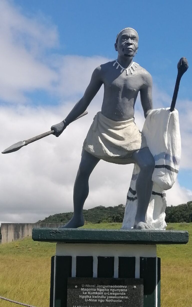
In the case of the Clay Pits, for instance, the land, just outside Gahamstown, was allocated to the Stubbs family to farm. AmaXhosa regarded this land as a common place they had been mining ochre clay for cosmetic purpose. Being barred from using it came as a surprise and insult to them. A similar thing goes with trading areas, like Fort Wilshire, on the banks of Nxuba. When trading disputes arose from its controlled environment they were resolved through official channels that involved authorities from both sides. But most trading happened illegally, leading to serious disputes between individuals that often led to the involvement of whole communities. Nkosi Maqoma initially followed his father’s policy of appeasing the white settlers, in failed attempts to coexist with the white settlers until they expelled him from his treasured land on the banks of Kat River. The famous prophet of amaXhosa, Ntsikana, himself influenced by the teaching of Van Der Kemp, is buried in the Kat River Valley. He tried to stir his followers towards being well deposed to missionaries even though this earned him no accolades, when he died his group had just been expelled from their traditional land to make way for the Coloureds, Mfengus and other traditional British collaborators.
Khanibazi indlebe kento zakuthi nimamele amathole endaba siwatsala kude kwintsobi yentsusa yethu, apho sibona umzi kaXhosa engena ekampini zemilo nezobudlelelwano nabasemnzini belizwe lika kumkanikazi uViktoliya. Kowu! Yaba ngumbhodamo nenyikityha yokufa ngamanenye amaxesha, kodwa ibuye yeyinzuzo ngamanye kwakunye nomqantsi onyuka isizwe sakuthi esanyanzeleke sawunyuka ukuze sibe yilento siyiyo ngoku. Makuvokotheke bantu bakuthi!